Subgrid topography from ETOPO
This how-to shows how to obtain subgrid-scale seafloor information from the ETOPO1 1-arc-minute global relief model and bin it onto an AIBECS grid. Two diagnostics are exposed:
fractiontopo— fraction of subgrid sediment in each wet box,roughnesstopo— proxy for topographic roughness.
Loading the ETOPO data requires Distances and NCDatasets so the AIBECSETOPOExt extension activates.
julia
using AIBECS, Plots
using Distances, NCDatasets
using JLD2 # required by `OCIM2.load`
Load ETOPO and the target grid
julia
grd, _ = OCIM2.load()
Z, lats, lons = ETOPO.load()                 # bedrock variant by default
(Union{Missing, Float64}[-56.0 -60.0 … -4229.0 -4228.0; -56.0 -60.0 … -4229.0 -4228.0; … ; -56.0 -60.0 … -4229.0 -4228.0; -56.0 -60.0 … -4229.0 -4228.0], -89.99999999999997:0.016666666666666663:90.0, -180.0:0.016666666666666666:180.0)Fraction of sediment per box
julia
f = ETOPO.fractiontopo(grd)
plothorizontalslice(f, grd, depth = 3000u"m", color = :viridis)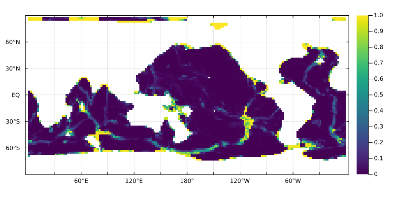
Cells with f > 0 at depth z correspond to grid boxes whose subgrid topography pokes above z.
Roughness proxy
julia
r = ETOPO.roughnesstopo(grd)
plothorizontalslice(r, grd, depth = 3000u"m", color = :inferno)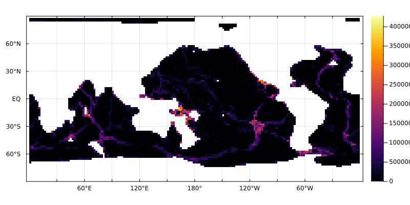
Higher values flag boxes overlapping the seafloor with significant elevation variability — useful when parameterising boundary fluxes (e.g. sediment release) or interior mixing.
This page was generated using Literate.jl.